
I always think of the Galtees as being a mountain range in County Cork as they lie just a stone’s throw from the north Cork town of Mitchelstown. Also north of Mitchelstown is the ‘Three Counties’ pub in a place near where the counties of Tipperary, Limerick and Cork meet.
My walk was to take me up Galtybeg and Galtymore, the latter being the king of the Galtee range at 918 metres (over 3,000 feet). My starting point for the walk was on the eastern side of the range at Coolagarranoe, in County Tipperary, just off the old N8, main Cork to Dublin road.
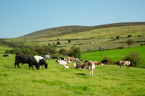
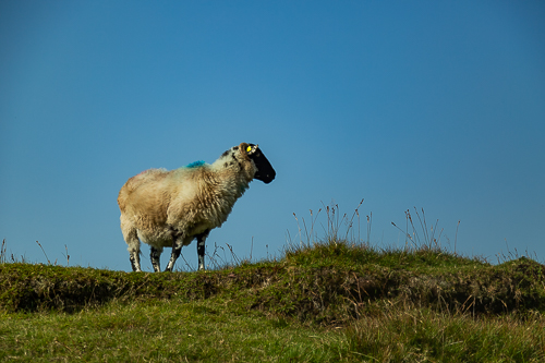
After a narrow fenced in start, the path leads through a field of cows with smatterrings of bright yellow gorse. Having passed through this first field, the climb begins in earnest, the cows are replaced by sheep and heather becomes the main vegetation. It is at this point one gets a good view of the broad flank of Galtymore.

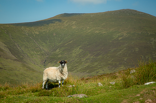
From this angle the mountain looks more of a gentle hill, rather than a beast of a mountain. Galtymore has to wait, however, with Galtybeg to the north being the first summit to be bagged.
Up to the base of the final ascent of Galtybeg, the path is a wide track and there is no danger of taking a wrong turn. I recognised the point where the path from the adjacent valley comes in to the right, a much harder path to follow. At the next fork in the track, the left branch is taken in the direction of Galtymore before then taking the path leading directly to Galtybeg. It is at the base of the steep ascent that the discernible path runs out and one has to pick one’s own way up the side of Galtybeg. It’s steep, but not that long, so one can soon admire the views from the summit.


The next target of the walk was Galtymore, the big one in the range. From the summit of Galtybeg, it didn’t look foreboding at all. The trouble is, one has to descend into the col between the two and from this lower position the challenge looked somewhat stiffer.

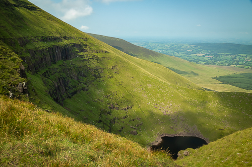
The col also draws one closer to the steep sheer cliffs that fall away to Lough Diheen in the bowl of the corrie. Swifts plucked flies out of the air as they swooped near the cliffs. I am not surprised to hear that peregrines nest in the area.
The col marks the county boundary between Limerick and Tipperary, with Galtymore lying in County Limerick and Galtybeg in County Tipperary. While taking in just two peaks, this walk captures the highest mountains in Counties Limerick and Tipperary!
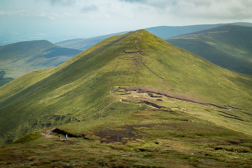
The climb up Galtymore from the Col is steep and offers up numerous false summits. The surprising thing is how broad the top is when one gets there.

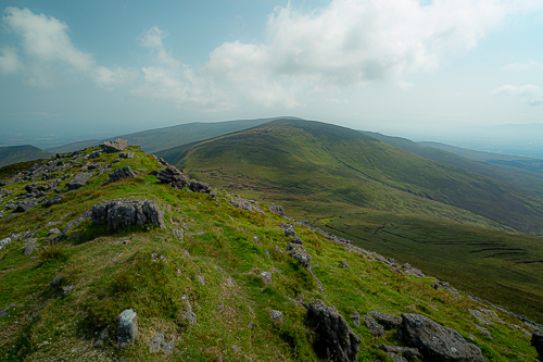
Walking along the ridge, another corrie comes into view, Lough Curra. From the main Cork-Dublin road the Mountains seem quite benign, but climb to the ridge and you get to see both sides of this contrasting mountain range.

Its time to descend Galtymore, look back across to Galtybeg and make ones way down to the rich surrounding valleys.

So there we go, the highest mountains in Limerick and Tipperary have been conquered. The highest mountain in County Cork is Knockboy (An Cnoc Bui in Irish), being close to the Kerry border. That still awaits.
I hope you enjoyed the walk.

You’ve been on some wonderful hiking adventures, John!
Beautiful shots.
LikeLiked by 1 person
Took the opportunity while I could 😄. Now it’s work in the garden.
LikeLiked by 1 person
That’s how it should be! Now get to work! 😁
LikeLike
Beautiful photos and description. Don’t know why but I never thought of Ireland as being mountainous– but now I know. Thanks for the education
LikeLiked by 1 person
Dannie, Ireland doesn’t really have the dramatic mountain ranges of Europe, or come to that Scotland. In thinking of Irish landscapes I would tend to think of the flat boglands, a large swathe of which is in the centre of the country, and rugged coastline, which includes towering cliffs and sandy coves. Rightly so.
It does have some good mountains, as you have seen, but probably little for the really serious mountaineer. What makes the Irish mountains compelling is that so many of the mountains are not far from the sea, which means that the hike typically starts at an altitude not too far above sea level, not 1500 feet up a 3,000 feet mountain. In addition, it means weather conditions are very hard to predict and can change in the blink of an eye. When you are rewarded with a view mind, it is often spectacular. Just set the camera to fast shutter speed to capture it.
LikeLike